Laws regarding prospecting and recreational mineral collecting change with property boundaries. We can all think of famous old mines and localities that are now in someone’s backyard. What if you could contact that someone and get permission to dig an old spot, or even prospect for a new one where no one has looked? It never hurts to ask, but it is often hard to figure out who owns areas of interest or where property lines truly lie.
When you download the app, you get trial use of it for 7 days and a choice of boundaries in one state. This app is subscription based and offers a premium subscription for $29.99/year that allows you to view property boundaries for one state, or an elite subscription where for $14.99/month or $99/year you can view property boundaries in all 50 states for one year. It is geared towards hunters, but it can be very useful for other outdoor activities like rockhounding, too.
When I downloaded the app, I chose Pennsylvania. Below is a screenshot of land around Hometown, PA
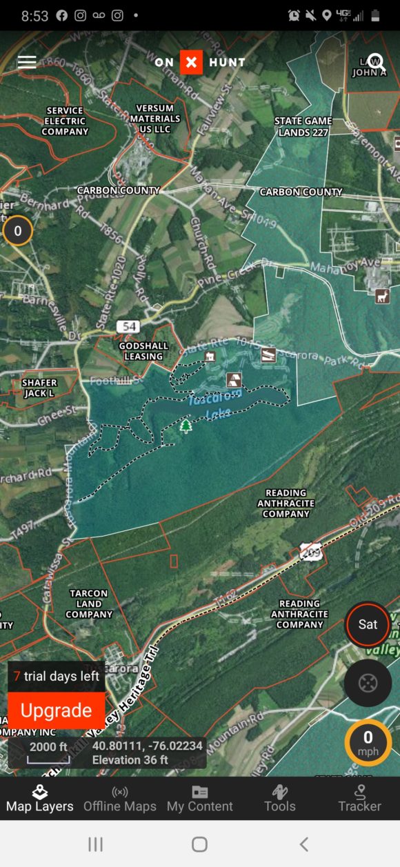
Overview of what OnXHunt shows on a sample screen
As you can see, the boundaries of various properties are outlined clearly on the screen as well as town names and counties. In addition, various useful navigation parameters such as speed and altitude are displayed.
When you click on a point, the boundaries are highlighted in green. A green cursor also appears at the point you click. Here I click on PA state gamelands and clearly the owner of the property is displayed as well as the size of the area. It shows that the PA State Game Commission is responsible for this land.
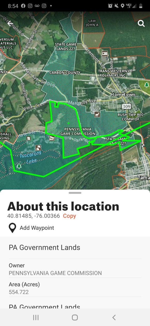
Gamelands shown clearly on the app, OnXHunt
Let’s say I wanted to check out the abandoned coal strippings west of town. Unfortunately, on the app this displays it is private property. When I click on the strippings, the pull up window provides the owner of the land, so if you wanted to explore it you could hypothetically contact them
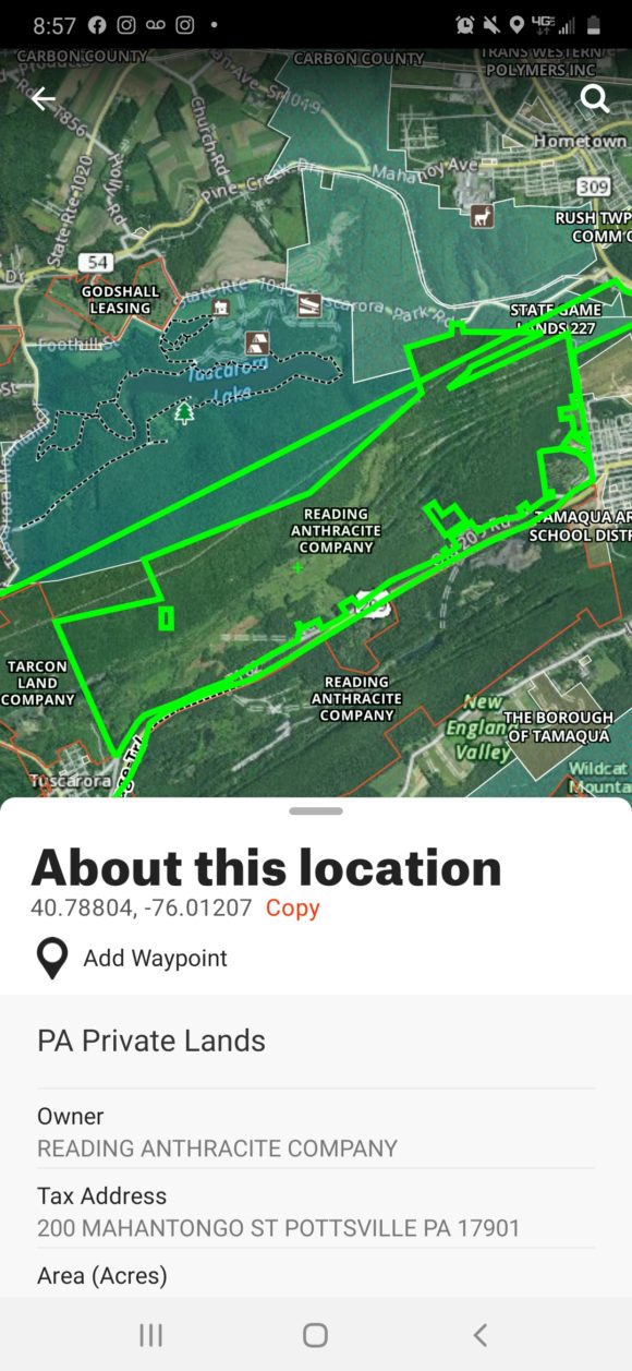
Property Ownership information shown on OnXHunt
Before this app was available, it was tedious searching records for owners and contacting them for permission. It is so easy here, in a very self explanatory maps like format.
Pros: Extremely intuitive and easy to use. An extremely practical app for mineral collecting that could be an indispensable tool that allows you to plan many more trips.
Cons: Kind of pricy, with a year subscription for 50 states costing $99. Perhaps it is really difficult keeping this app updated, as the task of finding property ownership is somewhat difficult at times. It would be worth it to someone who loves to rockhound, as I am sure your finds would exceed the cost of this app. Check out the website at OnXMaps.com