Using an App to find Property owners of Rockhounding Locations – onX Hunt- Finding Property Ownership Quickly for Prospecting

Laws regarding prospecting and recreational mineral collecting change with property boundaries. We can all think of famous old mines and localities that are now in someone’s backyard. What if you could contact that someone and get permission to dig an old spot, or even prospect for a new one where no one has looked? It never hurts to ask, but it is often hard to figure out who owns areas of interest or where property lines truly lie.
When you download the app, you get trial use of it for 7 days and a choice of boundaries in one state. This app is subscription based and offers a premium subscription for $29.99/year that allows you to view property boundaries for one state, or an elite subscription where for $14.99/month or $99/year you can view property boundaries in all 50 states for one year. It is geared towards hunters, but it can be very useful for other outdoor activities like rockhounding, too.
When I downloaded the app, I chose Pennsylvania. Below is a screenshot of land around Hometown, PA
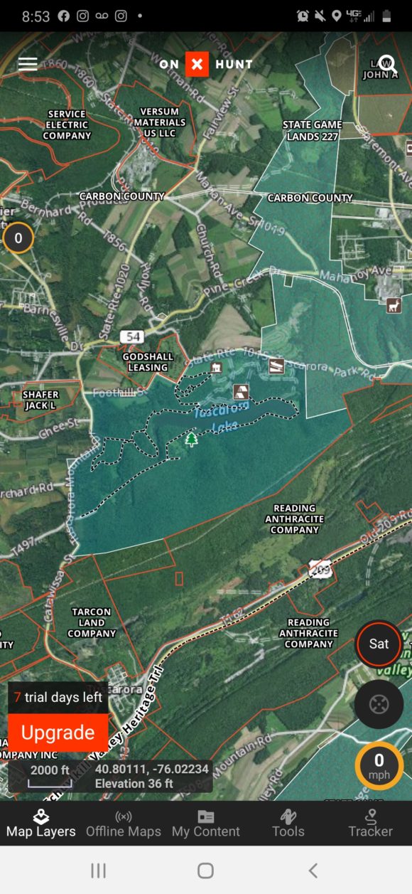
Overview of what OnXHunt shows on a sample screen

Overview of what OnXHunt shows on a sample screen


As you can see, the boundaries of various properties are outlined clearly on the screen as well as town names and counties. In addition, various useful navigation parameters such as speed and altitude are displayed.
When you click on a point, the boundaries are highlighted in green. A green cursor also appears at the point you click. Here I click on PA state gamelands and clearly the owner of the property is displayed as well as the size of the area. It shows that the PA State Game Commission is responsible for this land.
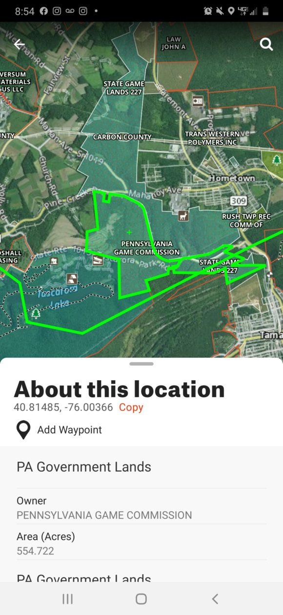
Gamelands shown clearly on the app, OnXHunt

Gamelands shown clearly on the app, OnXHunt


Let’s say I wanted to check out the abandoned coal strippings west of town. Unfortunately, on the app this displays it is private property. When I click on the strippings, the pull up window provides the owner of the land, so if you wanted to explore it you could hypothetically contact them
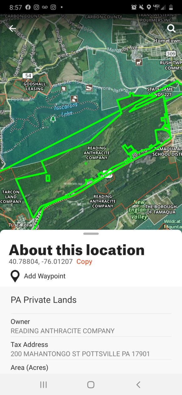
Property Ownership information shown on OnXHunt

Property Ownership information shown on OnXHunt

Before this app was available, it was tedious searching records for owners and contacting them for permission. It is so easy here, in a very self explanatory maps like format.
Pros: Extremely intuitive and easy to use. An extremely practical app for mineral collecting that could be an indispensable tool that allows you to plan many more trips.
Cons: Kind of pricy, with a year subscription for 50 states costing $99. Perhaps it is really difficult keeping this app updated, as the task of finding property ownership is somewhat difficult at times. It would be worth it to someone who loves to rockhound, as I am sure your finds would exceed the cost of this app. Check out the website at OnXMaps.com
Petrified Wood Near Colorado Springs – Pairing Old Information with New technology!

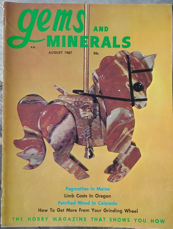
Cover of Gems and Minerals, August 1967 with a stone horse on the cover.

Rockhounding is a hobby that anyone can pick up, with very little in the way of costs besides time and transportation. Colorado is a wonderland of mountains, forests and rocks. Petrified wood is always fun to find and in many places around Colorado, abundant. Let’s show you a fun way to research locations from old data sources.

Cover of Gems and Minerals, August 1967 with a stone horse on the cover.

Available on eBay, Amazon, and at mineral shows across the nation, old magazines are full of rockhounding information!


By old data sources, we mean, old magazines, books and pamphlets about collecting minerals. Rockhounding was very popular in the 1950’s, 60’s and 70’s, which lead to the production of all sorts of printed material for rockhounds and lapidary enthusiasts. Today, even if rockhounding was nearly as popular as before, the internet is the land of independent media, yet, the information from those sources is so niche, it takes people specialized in transferring that information over to bring it to light, instead of waiting around for others to research and publish, you can take charge and research many things from your computer, using information from sources like this one, The August 1967 edition of “Gems and Minerals”.
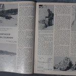
article in 1967 Gems and Minerals about collecting Petrified wood in Colorado

Click to see at full size


The article, entitled “Petrified Wood in Eastern Colorado” by Eugene M. Beason, describes a large wash where petrified wood is plentiful. Due to the nature of these alluvial rock deposits, every year new material is churned up by erosion by wind and rain, so if there was ample material in 1967, there would be ample material in 2016. Property ownership is always evolving and changing and must be verified by any possible explorer.

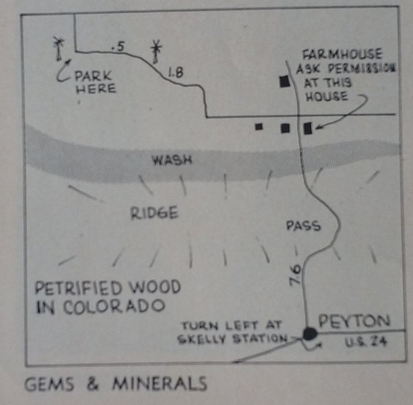
Map from 1967 Petrified Wood in Colorado Article in Gems and Minerals

Original Map to the Petrified Wood Collecting area in the 1967 Gems and Minerals article.

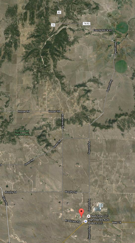
Many things have changed since this article was printed, nearly 50 years later. Instead of the turn being the “Skelly Station”, we can see the map is pointing to “Peyton Highway”, which runs north to go over a mountain pass and turns hard left (west) on “County Road 74/82”, which parallels the wash that is talked about in the article. I do not think there is any need to stop at the farmhouse listed in the article to ask for permission, as the ranch land gave way many years ago to the need for housing, as the populations in nearby Denver and Colorado Springs swelled, so did the growth out into the nearby countryside. 50 years ago there were just cows and a couple windmills, now there are hundreds of houses dotting the landscape. The issue is that the property in Colorado has two things going against it – Waterways can be included in property lines and property does not have to be POSTED to give first refusal to entry, as in most states in America.

map showing petrified wood collecting area north of Peyton Colorado

This map shows the area as shown in the illustrated map above.

As we searched google for information on this location, the terms “Peyton Petrified Wood” were coming up nearly blank. We did find an entry for it on Mindat.org, but it did not show anything directly from this location. Additionally, PeaktoPeak, a well known website for Colorado collecting, has a bit about petrified wood from that general area. Digging through field guides to Colorado, we could not find this location listed, could it have been one of the locations that simply slipped through an information hole, getting a two page article and then just…relegated to maybe popping up in a mention in a local club newsletter. It IS possible to contact the property owner, Tim Richardson, at timothy.k.richardson@gmail.com for guided tours of the petrified wood deposits.

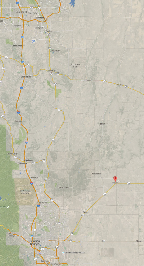
map showing the distance between denver and colorado springs and petyon colorado

as you can see, Peyton is not a far drive from Denver or Colorado Springs

Researching where rocks are found is necessary and interesting – don’t neglect to inspect old magazines and field guides from 40, 50, 60 years ago. You never know when a good location has simply fallen through the cracks and is waiting for you to find it and come explore! You’ll find that property ownership has changed over the years, however, don’t neglect to contact current property owners about that old information – many people are excited to find colorful rocks and minerals and are surprised they are underfoot.

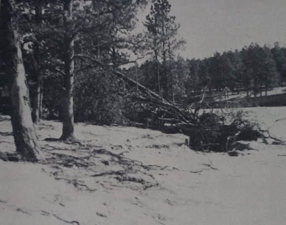
photo from gems and minerals article "Petrified Wood in Eastern Colorado"

“Looking down the wash where the good petrified wood is found. Floowaters that uprooted the tree in the foreground also uncovered new gem material.” – Photo by Eugene M. Beason.

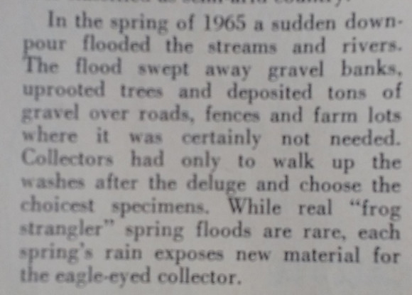
quote talking about how when it rained in 1967, the wash turned over new material.

So, when ever the rain is hard in colorado, new material is unearthed!